

 Dolly Sods
I have mentioned earlier that a very spiritual place for me is Dolly Sods. Throughout my life, this area has touched the inner most corners of my soul.
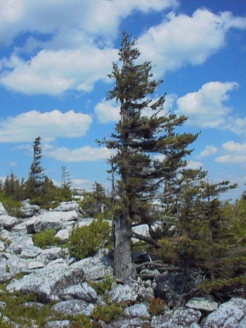
Dolly Sods is an area of high elevation wind-swept plains on the Allegheny Plateau. At elevations of 2,600 to over 4,000 feet, the area has extensive flat rocky plains, upland bogs, beaver ponds, and sweeping vistas. The plant life and climate on this high plateau resembles northern Canada, and many species found here are near their southernmost range.
The 10,215 acre wilderness was designated by Congress in 1975 and is located in West Virginia's Tucker and Randolph counties. The high plains area was once covered with 7 to 9 feet of humus. This humus layer was formed under a red spruce/hemlock forest - a forest where the average tree was four feet in diameter. Sadly, these once stately giants were felled during the timber rush of the late 1800's. Hot fires in the logging slash burned the area extensively and destroyed the fertile humus layer. In the inhospitable climate and present rocky soil of Dolly Sods, red spruce now struggle to attain 12" in diameter.
About the time the slash fires raged, local farmers burned the plains to create grazing land or "sods". The pioneer Dahle family used the sods for grazing about the turn of the century. Their German name became the present "Dolly" of Dolly Sods. The Civilian Conservation Corps planted red pine and other conifers in the area in the 1930's and assisted with the construction of Forest Road 75, now the main access into the Wilderness area.
In 1993, the Nature Conservancy purchased a large tract of land just north of the Wilderness Area from Quintana Corporation, a Texas oil company. This key purchase dramatically expanded the high plains region, following in a rough arc from Bear Church Rock to the north-western tip of the present Wilderness located near Cabin Mountain.

posted by Jim Meads @ 6:44 AM
![]()
0 Comments:
Post a Comment
<< Home